Garmin GPSMAP-396 | |
| |
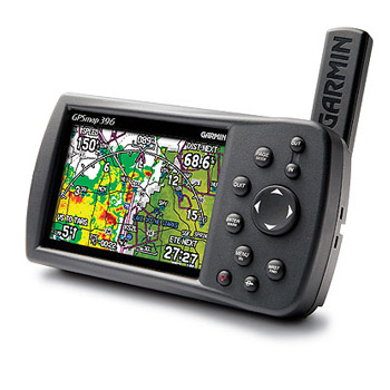
GPSMAP-396 Handheld | US$2,495.00
|
| |
| Unparalleled Situational Awareness
The GPSMAP 396 with XM WX Satellite Weather features Next Generation Radar (NEXRAD), Aviation Routine Weather Reports (METARs), Terminal Aerodrome Forecasts (TAFs), Temporary Flight Restrictions (TFRs), Lightning and Winds Aloft, and several other important weather products to help pilots make informed navigational decisions. This new aviation handheld continues to reduce pilot workload by displaying Traffic Information Service (TIS) data when interfaced to the GTX 330, and can channel frequencies with the touch of a button when interfaced to the SL30 nav/comm radio. The GPSMAP 396 is also capable of receiving XM Satellite Radios 130-plus channels of music, sports, news, talk, and entertainment programming through a subscription. Once on the ground, the unit continues to provide pilots with invaluable information in a car or boat via automotive or marine navigation modes.
Pilots can customize the map display to overlay XM WX data directly over the units Jeppesen and topographic map databases, or display individual weather products on the exclusive weather explorer page. In terrain mode, the GPSMAP 396 combines inputs from built-in terrain, obstacle, and electronic flight databases to give pilots a vivid depiction of proximity hazards that require their attention. Pilots can customize their own minimum-clearance limits to receive terrain cautions, which pop up as digital thumbnail images.
Viewing the display in any light is easy, thanks to the devices 256-color, high-resolution (480 x 320-pixel) TFT display. The unit also features USB data transfer, fast processing speed, and a rechargeable lithium-ion battery pack.
XM Satellite data and audio is delivered to the GPSMAP 396 through Garmins new GXM 30 smart antenna, which is included with the unit. The compact GXM 30 (roughly three inches in diameter) processes all weather information and sends the finished data to the GPSMAP 396 for display.
With the press of a button, the unit toggles into automotive or marine mode. When on the road, users can load the GPSMAP 396 with optional MapSource® City Select® software for voice-prompted turn-by-turn directions to addresses and points of interest. The optional auto kit includes a friction and dash mount, a cigarette-lighter adapter with speaker output, a 128-MB data card, and a MapSource City Select CD-ROM for detailed maps of the United States.
On the water, the GPSMAP 396 offers a worldwide marine database and U.S. tide data. When paired with MapSource BlueChart® marine cartography, this waterproof unit displays information including depth contours, inter-tidal zones, spot soundings, wrecks, navaids, port plans, restricted areas, cable areas, and anchorages.
An automatic logbook also calculates your flight time and automatically records departure and arrival locations. When used with Garmin's free logbook softwareFlightBookthis feature makes light work of maintaining your logbook. Your flight information will be stored in the unit and can be downloaded to this exclusive Flightbook software at any time.
Garmin part number: 010-00425-00
Suggested Retail Price:
$2695.00 U.S.D. (for domestic US market only)
GPSMAP 396 Features: WAAS-enabled, 12 parallel channel GPS receiver
Adjustable quad-helix receiving antenna with remote antenna capability
Display Size: 3.8 Diagonal, 480 x 320 pixels
Display: 256-color, sunlight readable TFT with adjustable backlight
Unit Dimensions: 5.7 W x 3.2 H x 1.9 D
Adjustable yoke mount
GXM 30 Smart Antenna for XM Satellite Radio Services (subscription necessary)
GA 25BNC remote antenna
Terrain/obstacle display with pop-up warnings
Accepts standard Garmin data cards and pre-programmed data cards
Built-in basemap with automatic routing and turn-by-turn directions
Provides voice-prompt road guidance when the power/speaker cable is connected
The basemap shows cities, interstates, coastline detail, and U.S. tide stations
Rechargeable lithium-ion battery offers 5 to 15 hours of use depending on backlight settings
Provides separate serial and USB interfaces
One RS-232 serial ports
3,000 user waypoints with an expanded list of waypoint symbols
50 reversible routes with 300 waypoints per route
10,000 point automatic track log; 15 saved tracks, 1,000 saved track points each
Project your position on the map with the configurable complex heading line
Water resistant, IEC 60529 IPX7 standards (submersible to 1 meter for 30 minutes)
Package includes MapSource Trip & Waypoint Manager CD-ROM
|
| |
| Payment Methods |
| Visa, MasterCard, Interac, Certified Cheque, Money Order, Wire |
|